Prepare for stormy days ahead, says weather department
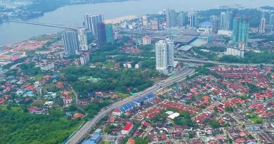
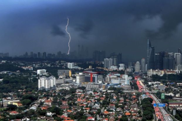
PETALING JAYA: Bring out your umbrellas and rubber boots because heavy rains are expected to lash out soon, bringing with it high chances of floodings.
Malaysian Meteorological Department director-general Alui Bahari said the north-east monsoon was expected to last until March and has already brought heavy rainfall to Kelantan and Terengganu.
Rain will make its way to Pahang and Johor before shifting to Sabah and Sarawak later in the season.
“These states are expected to experience four to six heavy rainfalls as in previous years,” he said.
The situation could be worsened by spring tides that take place during the new and full moons.
While the east coast is typically the worst hit by floods during the rainy season, west coast residents should also be on the alert.
Last year, Penang was also hit by major floods, where the state sought help from armed forces after winds and rain lashed out, causing landslides and falling trees.
However, Alui said he did not expect such rainfall over Penang and Kedah this season.
Universiti Kebangsaan Malaysia’s Professor of Climatology and Oceanography Prof Dr Fredolin Tangang said the country was entering the monsoon period earlier compared to the average mid-November onset date.
However, he said this was within the “natural variability” of the monsoon period, which was affected by phenomena such as El Nino.
“Sea surface temperatures in the Eastern-Central Pacific Ocean are warmer than usual, indicating the progression of a weak El Nino by year end or early next year,” he said.
Due to this, he said, there was likely to be heavier rainfall in southern Peninsular Malaysia, which includes Johor and the Klang Valley.
He added there was a low possibility of extreme rainfall, which could lead to large-scale flooding as the Kelantan and Terengganu floods in December 2014.
According to his research, three phenomena should take place for such extreme weather to occur.
Firstly, he said there should be cold surges from the north and secondly, the Borneo vortex, a wind circulation system should be located close to Peninsular Malaysia.
“The Madden-Julian Oscillation (MJO) must also be active and its low pressure-centre must be located near West Sumatra,” he said.
The MJO is a phenomenon in which a low pressure system crosses eastward from the Indian Ocean to the Pacific Ocean.
The people can monitor weather and flood situations through http://portalbencana.nadma.gov.my and www.met.gov.my or download relevant mobile applications such as myCuaca and myJPS.
Source: The Star